


Celebrated marine area in crisis
Over 300 years ago, early navigators returning from long sea voyages mistook Hangklip on the eastern edge of False Bay for Cape Point. Thinking they had circumnavigated the Cape, they sailed into what they believed was Table Bay, when in fact they had not yet reached Cape Town. Thus, the largest bay in South Africa was named.
But the history of the bay extends far further back in time than the arrival of European sailors. The indigenous Bushmen — historically known as the Sonqua — were the first known people to live in and around False Bay. Archeological records from caves in the area date their presence back 250,000 years. They were hunter-gatherers who ate shellfish, the occasional stranded whale, game, tortoises, and various edible plants.
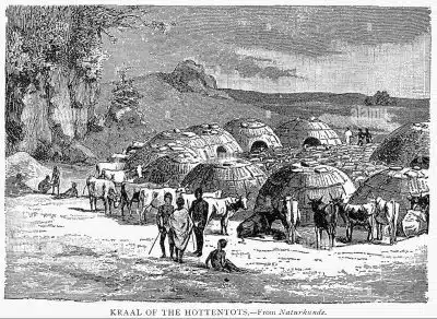 About 2,000 years ago the nomadic herders known as the Khoi — a contested term as the name was imposed on clans such as the Goringhaicona, Gorachoqua, Cochoqua, etc. who shared a similar language and culture — appeared in the Cape Peninsula.
The Khoi, whose language was similar to the Sonqua and believed to share the same origins, roamed the land with their cattle, moving across False Bay and the peninsula between grazing lands such as the banks of the Liesbeek River that flows down from Kirstenbosch National Botanical Garden, northwards through the southern suburbs, to enter the sea at what used to be a wetland estuary, but is today the semi-industrial area of Paarden Eiland.
That was until the Vereenigde Oostindische Compagnie (VOC), or Dutch East India Company, set up a refreshment station for their ships in 1652, putting Jan van Riebeeck in charge of governance. Under van Riebeeck, the VOC parceled out land to European settlers to grow vegetables for the ships on their way to, or returning from, the East Indies. The resulting dispossession of the Khoi from their traditional grazing lands along the Liesbeek is believed to be the first act of colonial land dispossession in southern Africa.
The community of ‘free burghers’ or citizens grew, and by 1672 European farmers had been apportioned land in the False Bay area, about 20 km south of the VOC castle built to overlook Table Bay. Disputes between the Khoi and European settlers over access to land led to violent conflicts. In trying to regain their territory, the Khoi launched attacks on the Dutch but lost many men. Read more about this history here.
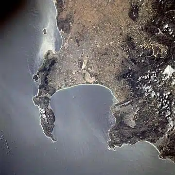
Satellite view of False Bay, Cape Town, South Africa


Meeting of the oceans
False Bay is a body of water in what is commonly seen to be the Indian Ocean, with the view often held that the Indian meets the Atlantic Ocean at the western headland of the bay, Cape Point. This view is reinforced by the water in False Bay generally being warmer than the water on the western side of the peninsula, and a line denoting different shades of blue extending southwards from Cape Point. However, both these phenomena are due to currents and prevailing winds across the peninsula, with the actual meeting point of the oceans being at the southernmost tip of Africa, Cape Agulhas.
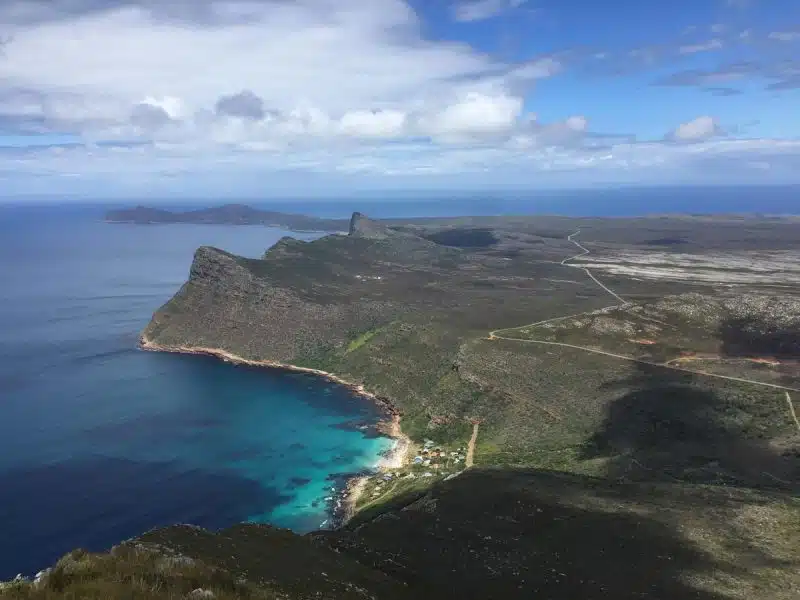
View of the long arm of the Cape Peninsula that marks out the western side of False Bay © Jacqueline van Meygaarden
False Bay’s eastern flank is defined by the Hottentots Holland Mountains, while its equally dramatic western flank sees the Cape Peninsula’s famed peaks plummeting into its waters. The sandy northern part of the bay is gently sloping for the most part, extending 35km across the isthmus that forms the low-lying Cape Flats, once a vast area of shifting dunes and wetlands that housed a variety of fauna, including hippopotami. The Cape Flats are now built up, with people of colour having been forcibly moved there by the apartheid regime, and house the majority of Cape Town’s population. False Bay’s southern side is open to the ocean and is 40 km across at its widest point, with the land perimeter being approximately 116 km as estimated from a 1:50,000 scale map.
False Bay contains South Africa’s largest naval base at Simon’s Town, and small fishing harbours in Kalk Bay and Gordon’s Bay.

Simon’s Town Naval base in False Bay © Jacqueline van Meygaarden
Development in False Bay
The first recorded history of Kalk Bay dates back to governor Simon van der Stel’s visit in 1687. He noted the small sandy bay and that a lion carried off one of the sheep they had brought along. With fresh water from a perennial stream, varied seafood among the adjacent rocky shores, and shelter from the wind, there is evidence of Kalk Bay having been inhabited by the Sonqua for tens of thousands of years.
Simon’s Town was established as a winter anchorage in 1743 after the seasonal northwesterly gales had driven one too many ships ashore in Table Bay. Kalk Bay developed into a fishing community populated by indigenous people; freed slaves who had been trafficked from Malaysia, Java, and Madagascar; and deserters from visiting ships. A fishing community, using boats powered by oar and sail, developed, with boats generally going up to 16 km offshore. Commercial whaling began in 1806, with the nearby 1.5 km sandy stretch of Fish Hoek used to beach the whale carcasses for processing. Over-exploitation led to the demise of whaling by 1871.

While the railway, which came along 12 years later improved access to markets for the fishers, the building of the viaduct across the beach severely reduced the width of the beach above the high water mark, leaving fishers boats exposed to rough seas in bad weather. When a storm smashed 17 boats — representing almost half the fleet of 38 boats at the time — against the viaduct’s stone wall in 1898, the fishers agitated for protection for their boats.
At around the same time, trawlers started coming into the bay, making larger catches, and damaging the seabed and fishing banks at the same time. The Kalk Bay fishers petitioned against trawling in the bay and in 1899 a three-mile limit on trawling was set. Trawling is still not allowed in False Bay.
But one positive spin off of the trawling industry was the pressure they had created for a proper harbour. Plans were set in place but were stymied by the economic depression following the South African (Anglo-Boer) war.

1900s Early Kalk Bay
By 1906 there were 40 boats at Kalk Bay, making it third largest in terms of fleet and size of fishery after Table Bay and Algoa Bay. Eventually, under the new Union Government, construction began in 1913. Work was completed five years later, making Kalk Bay the first dedicated fishing harbour to be built in South Africa, bringing in abundant catches of yellowtail, snoek, and silverfish using handlines rather than nets.
Post 1994, the fishing community faced new challenges related to the allocation of fishing quotas by the state, and dwindling fish stocks due to commercial fishing elsewhere off the Cape coast. Some nearshore fishing banks in the north eastern section of the bay were also no longer productive, according to one fisher who had been fishing in the bay for decades. This was possibly due to high pollution levels from poorly treated wastewater released into the bay. However, Kalk Bay remains a working fishing harbour with traditional wooden boats, where the public can buy fresh fish loaded off on the quay, caught by fishers who have depended on the harbour for their livelihood for generations.
For more on False Bay watch the video below from the International Ocean Institute South Africa (IOI-SA).
False Bay beaches polluted
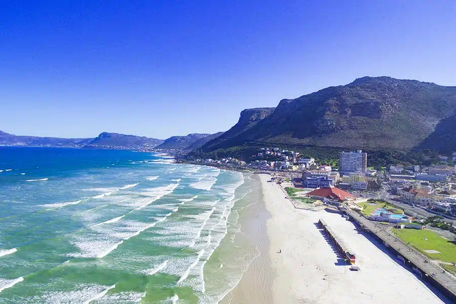
Muizenberg Beach and beachfront
False Bay is often presented as a picturesque bay with a clean, white beach that stretches for kilometres from Muizenberg to Gordon’s Bay, flanked by dramatic mountains forming the ‘horns’ of the bay with numerous inviting sandy coves and villages. But in March 2020, after media reports and public demand for the City of Cape Town to publicise its inland and coastal water quality data, it was revealed in a long-awaited report that many of False Bay’s beaches are so polluted that swimming in the surf could be dangerous to health.
Titled Know your Coast, this presented annual results from 2015 to 2019 at 90 testing sites where the City collects fortnightly samples of water from the surf zone and tidal swimming pools. This was the first report available to the public on coastal water quality since 2013, when the City stopped presenting water quality results to subcouncils. Since then Know Your Coast reports have been published annually with the exception of 2023 and 2024. They present results from around Cape Town’s coastline, including 33 recreational nodes and 21 other coastal monitoring points in False Bay, where the City’s Scientific Services tests for colony-forming units (cfu) of Enterococcus bacteria, an indicator species for the presence of human faecal matter and associated pathogens in the water.
Sites are rated on a four-point scale: Excellent, Good, Sufficient, or Poor. The minimum acceptable standard for recreational use is Sufficient. A Poor rating means the level of faecal bacteria exceeds the maximum allowed under South Africa’s national guidelines for recreational water use. By far the largest and most common source of these pathogens is untreated or partially treated sewage released into the sea from the City’s wastewater treatment systems. But while the City’s own samples have shown high levels of faecal bacteria, they don’t measure chemical contamination contained in sewage, which is another, and possibly even more serious long-term threat.

False Bay Water Quality Ratings Distribution 2019, KYC Report 2019

False Bay Water Quality Ratings for Recreational Nodes 2019, KYC Report 2019

False Bay Water Quality Ratings for Recreational Nodes 2021, KYC Report 2021

False Bay Comparative Water Quality Ratings map key 2020 to 2021, KYC Report 2021
The picture across the monitoring period has been one of chronic, persistent pollution at the majority of False Bay sites, punctuated by a brief improvement in 2021, before a large gap in the data record in 2022 and 2023. In 2019, 41% of False Bay recreational nodes were rated Poor. In 2020, that figure worsened slightly to 44%. The 2021 report — the most positive in the series — showed improvement, with only 33% of nodes rated Poor. Striking gains were recorded at Macassar Beach, which improved from Poor to Good, and at Strand Beach and Strand Harmony Park, both of which reached Excellent for the first time. The report attributed these improvements in part to major capital upgrades at the Zandvliet and Cape Flats wastewater treatment works, though it cautioned that water quality in the north-eastern bay remains highly variable.
That progress was followed by two years in which the City was unable to generate meaningful annual water quality categories at all. In both 2022 and 2023, the City’s Scientific Services laboratory could not analyse Enterococcus samples for a significant portion of the monitoring year, officially due to procurement failures. The data gap left the public without an official picture of water quality for two consecutive summer seasons, and coincided with a period of severe load shedding that caused sewer pump station failures and raw sewage spills at several beaches, including Muizenberg and Fish Hoek.

Recreational Nodes False Bay Coast from the City of Cape Town April 2026 Water Quality Dashboard
The 2022/2023 gap in water quality data coincided with significant public controversy. In November 2023, ahead of the peak holiday season, the City removed the colour-coded health risk indicators from its monthly coastal water quality report, the same indicators that had previously shown chronic Poor ratings at many False Bay beaches, and published a statement claiming 13 key popular beaches and tidal pools in False Bay had “excellent” water quality. Civil society groups and media outlets in turn declared a “code red”, publishing the City’s own raw E. coli data which showed that 12 of 13 of these beaches were in fact polluted on the standard long-term measure. The City appeared to subsequently remove its standard reports from its website, replacing them with results from a short-term independent seasonal testing programme for enterococci at these beaches.
The dispute over how water quality data is presented has since deepened. In January 2025, a citizen-funded independent testing campaign, Project Blue, found that 38% of False Bay sample dates exceeded safety limits for E. coli and Enterococci. The City and the Democratic Alliance challenged the accreditation of the laboratories used. Project Blue researchers stood by their findings. Then, in July 2025, a peer-reviewed paper published in the journal Water Resources Research by a team led by Professor Lesley Green of Environmental Humanities, at the University of Cape Town, coined the term “contaminant denialism” to describe 18 documented strategies by which the City had, over more than a decade, minimised, obscured, or misrepresented independent scientific findings on coastal contamination. The City strongly denied the findings.
Following this, the City appears to have removed the standard coastal water quality reports from their website, replacing them with the results of the weekly “independent” enterococci tests being conducted over the tourist season. The most recent data, from the City’s Coastal Water Quality Dashboard updated in April 2026, shows that on the five-year rolling average — the most reliable long-term measure — chronic pollution persists at Muizenberg Surfers Corner, Sunrise Beach, Strandfontein Beach, Monwabisi Beach, Macassar Beach, most of the Strand nodes, and Gordon’s Bay East Beach.
The situation at Strand has been particularly severe. In October 2023, the collapse of the Trappies Bulk Sewer line caused raw sewage to flow through the stormwater system directly onto the main beach. Throughout 2024 and into 2026, beachgoers reported serious bacterial infections — including antibiotic-resistant strains — after swimming there. Residents and the advocacy group Bays of Sewage have continued to demand a real-time water quality flag system, arguing that fortnightly sampling and physical warning signs are wholly inadequate to protect public health.
On the shorter-term summer 2025/26 measure, some sites show improvement according to the city: Muizenberg Pavilion has reached Excellent, and Fish Hoek Beach has improved to Good. Bikini Beach and Kogel Bay remain consistently Excellent across all timeframes.
But while the microbiological pollution in False Bay poses a health risk — particularly to the young, elderly, and immunocompromised, who face the possibility of gastrointestinal illness, ear, eye, nose, and throat infections, and in severe cases antibiotic-resistant bacterial infections — the larger and less visible problem remains the persistent organic pollutants, pharmaceutical products, and industrial chemicals released into the bay with sewage effluent and stormwater. Standard bacterial monitoring does not test for any of these substances. The City’s own research into chemicals of emerging concern in coastal waters has been conducted only twice — in 2017 and 2021 — and forms no part of the routine monitoring programme.

Photo by Leslie Petrik
Chemical pollution

Sewage, or wastewater, does not just come from flushing toilets. It also contains water from domestic showers, baths, and kitchen sinks, as well as wastewater from industrial sites — such as abattoirs – and from hospitals and nursing homes, among others.
Besides faeces and urine, and the host of bacteria that accompany them, the wastewater in the sewerage system contains persistent organic pollutants from shampoos, soaps, disinfectants, skin products, perfumes, hair products, dental care products, and surfactants, as well as these compounds’ degradation products. Sewage also contains industrial byproducts such as perfluorinated compounds used in paints, fire fighting and waterproofing, pesticides and herbicides from domestic and commercial usage, as well as pharmaceutical compounds, including antibiotics, antiretrovirals, blood lipid regulators, natural and synthetic hormones, Beta-blockers, antidiabetics, antihypertensives, etc. This is because the body does not absorb all the medication administered; much of it is excreted either in unmetabolized form or as secondary metabolites. People suffering viral infections will also excrete the virus into the sewerage system, and often, medication that is out of date is thoughtlessly flushed down the toilet.
Thousands of these persistent organic pollutants do not break down easily, resulting in them also being called “forever chemicals”. And when they do break down, they form other compounds. The effects of the majority of these manufactured compounds have not yet been studied, and we do not know what happens when they come into contact with each other, nor what effect this complex cocktail of chemicals in the sea has on marine life.
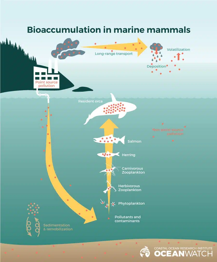
Because they persist in the environment, marine biota, from plankton to seaweed to molluscs to fish, are continually exposed to them, and studies have found they accumulate in marine organisms, which process them at a slower rate than they ingest them. They also accumulate up the food chain. This is known as ‘bioaccumulation’.
The impact of this bioaccumulation of chemical contaminants on seabirds, particularly the African penguin, has been the subject of recent studies. There are approximately only 10,000 breeding pairs of the African Penguin (Spheniscus demersusis) left. They went from being the most abundant seabird in Namibia and South Africa to being listed as Endangered on the IUCN Red List of Threatened Species in just 20 years. Various factors have contributed to this decline, from climate change, oil spills, human disturbance, predation, overexploitation of pelagic fish, parasites, and other potential stressors being the contaminants or emerging concerns (CECs). Approximately 70% of all African penguin colonies breed in close proximity to cities and/or harbours in South Africa. So the impact of CECs should be considered as a stressor on seabirds, and is likely to contribute to the decline of the African penguin.
These chemical contaminants affect marine ecosystems around the world. There is a substantial amount of research about the impacts of CECs on marine environments, and wastewater treatment plants are reported to be one of the main sources of CEC release. As with much of the research on this Water Stories platform, CECs are identified to be contaminating the marine environment and bioaccumulating in several marine species.
Chemicals in our fish
In a peer-reviewed paper published in 2019, Professor Leslie Petrik at the University of the Western Cape’s Chemistry Department, and Cecilia Y. Ojemaye found at least 12 persistent chemical compounds in fish obtained at the Kalk Bay harbour. Species tested include snoek, bonita, hottentot (Cape bream), and panga, obtained from random daily commercial catches sold at Kalk Bay harbour in late 2017.
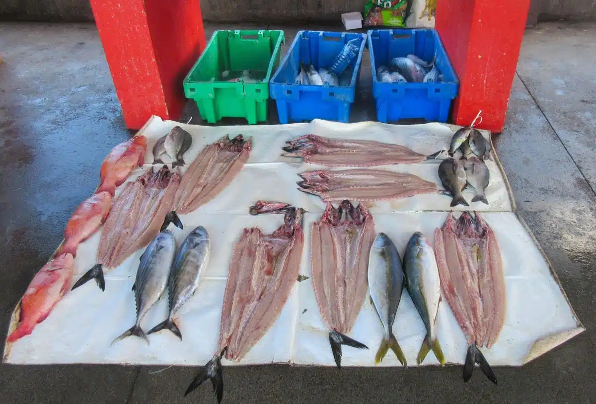
Fresh fish sold at the fish market at the Kalk Bay Harbour ©Cannundrum
Petrik and Ojemaye tested for 15 different chemical compounds in the fish fillets, gills, liver, and intestines. These include the analgesic/anti-inflammatories diclofenac and acetaminophen, the antiepileptic drug carbamazepine, the antibiotic sulfamethoxazole, the disinfectant triclosan, as well as various industrial chemicals found in pesticides, flame retardants, and personal care products. These were all present in various parts of the fish tested.

Crayfish net cages at Kalk Bay Harbour
“Overall, diclofenac had the highest concentration out of all the pharmaceutical compounds”, notes the report, while the antibiotic sulfamethoxazole was detected in at least one part of all the fish species (fillet, gills, liver, and intestine), stated Petrik and Ojemaye.
The industrial chemicals, or perfluoroalkyl compounds (perfluoroundecanoic acid, pefluorodecanoic acid, perfluorononanoic acid, pefluorooctanoic acid, and perfluoroheptanoic acid), all “showed a high risk, both acute and chronic, in the fillet parts of the fish which is the part humans consume”.
Perfluoroalkyl compounds are used for non-stick cookware, in paint, waterproofing, and as fire retardants in domestic and industrial applications, among other uses.
The study shows that persistent organic compounds and perfluoroalkyl compounds accumulate, not only in fish but also in other marine organisms and that much of the PFAS contamination arises from inadequately treated sewage effluents that are released into False Bay via surfzone and estuarine discharges.
Source of contamination
There are many challenges faced by cities around the world which have expanding populations, including the strain urbanisation and human population place on the environment. Cape Town’s population has more than doubled in the last 30 years, and with the increase in number of people, there is a subsequent increase in the pollution discharged into the environment.
Beyond the impact of plastic, pollution of the marine environment comes from effluent discharged from sewage treatment works, sewage spills, and waste disposed of in the stormwater system which flows directly into the ocean. Weed spraying programmes as well as pest control and agricultural runoff also releases pesticides and herbicides into waterways flowing into the ocean. However, by volume, the largest source of pollution is wastewater treatment works which are supposed to treat sewage and other wastewater to acceptable levels before releasing it back into the environment as treated effluent. The volume of wastewater being generated and treated is directly related to the daily usage of potable water in the city. (It should also be remembered that Cape Town has three marine outfalls on the Atlantic coast through which tens of millions of litres of sewage is pumped into the ocean every day without being treated. See the section on the Marine Outfalls in Cape Town).
The City’s Know Your Coast Report 2021 states: “Every day, the City deals with the domestic and industrial wastewater and solid waste generated by Cape Town’s more than four million people, and another one million bordering the city. In terms of wastewater generated, this amounts to between 485 and 618 million litres (approximately the volume of 200 to 250 Olympic swimming pools) every day within the city; while our catchments also discharge effluent and contamination from neighbouring municipalities. The discharge of all wastewater has a significant impact on nearshore coastal water quality.”
What the City does not state is that many of its wastewater treatment works fail to treat received sewage to acceptable levels. Nor do they remove persistent organic compounds, pharmaceuticals or industrial chemicals from the wastewater.
In December 2023, four of the seven wastewater treatment works that release effluent into False Bay, were failing to treat the wastewater to acceptable standards (>1.001 faecal coliforms/100ml). Combined, they were releasing about 274 million litres of untreated or partially treated sewage into the bay every day.
Scientists such as Petrik and her team have found that persistent organic compounds, pharmaceuticals and perfluoroalkyls are present in large quantities in this sewage being discharged from poorly functioning waste water treatment plants. The research was funded by the National Research Foundation (Project 118754, SANOCEAN program) and the University of Cape Town Sustainable Development Goals Post-Doctoral Fellowship Programme. These chemical pollutants are not removed in the wastewater treatment process at present, even when wastewater treatment plants are working properly (see published research, WRC Report TT 742/1/17 and WRC Report TT 742/3/17).
In a study done in 2024, Cecilia Ojemaye and team measured the levels of five perfluorinated compounds (PFAS) in sewerage effluent from the Zandvliet Waste Waste Treatment Plant (WWTP) as it is discharged into False Bay in the Indian Ocean. Samples were taken at the influent and effluent sites from this municipal WWTP, and then the chemical fingerprint of sewage was tracked to determine the extent of the dispersal in a previously pristine marine environment, and how each chemical accumulated in different marine organisms. The researchers wanted to assess the contamination impact zone and understand the potential ecological risks.
The impact of bioaccumulation of these compounds extended more than 60 km from the point of discharge in limpets, starfish, sea snail, and mussels, seaweed (sea lettuce, red algae etc). The researchers concluded that continuous release of toxic effluent into the sea may have acute or long term effects on the marine biota. And that waste water needs to be treated beyond the primary and secondary levels, before it is discharged into marine environments, to safeguard against long term marine contamination.

Wastewater Treatment facilities around Cape Town. © Denzil Bent
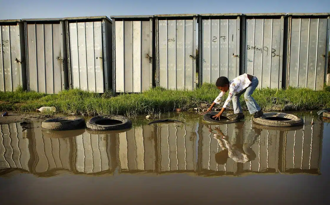
Cape Town informal settlement © Business Live
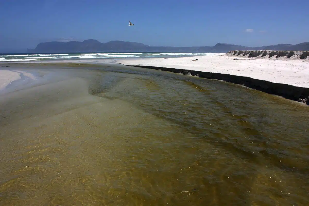
Polluted effluent flows from the Cape Flats Wastewater Treatment Works into False Bay at Strandfontein. ©Steve Kretzmann
Impacts on the estuarine environment
The benthic layer refers to the bottom zone of a water body, including the sediment surface and the organisms living in or on it. It is a critical ecological zone involved in nutrient recycling and supports many unique organisms known as benthos. These organisms, from microscopic bacteria to larger crustaceans, sustain important food webs and help maintain water quality.

Bernard DUPONT from FRANCE, CC BY-SA 2.0, via Wikimedia Commons
_to_be_used_as_bait_..._(52675353148).jpg)
In the Zandvlei Estuary, a seasonally closed urban estuary within Cape Town, on the False Bay coastline (see map), researchers have documented alarming levels of pharmaceuticals accumulating in the benthic environment. Of particular concern are the levels of persistent pharmaceuticals detected in endobenthic sandprawns (Kraussillichirus kraussi), species that burrow into the sediment and serve as key ecosystem engineers by influencing sediment structure and local biodiversity.
Researchers found that these pharmaceuticals (such as acetaminophen, carbamazepine, and sulfamethoxazole) are present at elevated concentrations in estuarine waters and tissues of sandprawns, with significant bioaccumulation factors indicating long-term exposure and retention. These contaminants can jeopardise the sandprawns’ physiological health and disrupt their vital ecological role, which could cascade through the food web affecting other organisms, including commercially important fish.
This study underscores how the benthic layer in urban estuaries acts as both a sink and a point of exposure for persistent pharmaceutical pollutants, highlighting the urgent need for improved wastewater treatment and environmental management to protect these fragile estuarine ecosystems.

Location of the Zandvlei Estuary and marina within (i) Cape Town (rectangle) and (ii) South Africa (circle) with sampling sites (1–5) shown. The arrowed line near site 5 denotes the sandprawn biotope.
These localised estuarine impacts mirror a broader pattern of benthic contamination across False Bay. A 2026 baseline study of macrofauna and nematode communities by B Mazeka et al found the highest concentrations of pharmaceutical compounds and metals — including diclofenac and copper — in the north-eastern part of the bay, driven by sewage discharges and urban runoff. While researchers did not detect acute community collapse at the time of sampling, they cautioned that the continuous release of these contaminants likely causes chronic and sublethal harm to marine life that is difficult to measure using standard taxonomic methods alone. The findings highlight the urgent need for long-term, spatially replicated monitoring and improved wastewater treatment to prevent cumulative ecological damage to the bay’s benthic ecosystems.

Your pharmacy in the ocean?
Beyond the studies conducted on fish, sandprawns, microfauna and nematodes above, Cecilia Y. Ojemaye and Professor Petrik studied the presence of metals, pharmaceutical and personal care products in the marine environment in False Bay.
In their peer-reviewed paper published in 2020, they found persistent chemical compounds in various environmental samples from False Bay. Diclofenac (a non-steroidal anti-inflammatory drug) was the most dominant compound detected, with higher concentration than the other pharmaceutical compounds, as well as being present in almost all the samples from the different sites, including seawater and sediment, marine invertebrates, and seaweed.

© Photo: Hayd Basson | southafrseaweeds.uct.ac.za
In a 2026 peer-reviewed study of samples collected in 2018 from eight sites around False Bay, marine invertebrates such as mussels, limpets, sea snails, starfish and sea urchins, and five types of seaweed were tested for 18 metals and metalloids. Levels varied widely between species and sites, but under the study’s long-term consumption model, arsenic exceeded the standard risk threshold at every site and the combined risks for all edible invertebrates sampled were above the threshold. This points to potential non-carcinogenic health risks for people who regularly eat these species, and reinforces the need for regular, multi-species monitoring of metals and other pollutants in the Bay’s marine life.
In a different but related recent study published in 2025, an international team of scientists based in South Africa and the UK looked at the impact of chemical compounds on human sperm. They tested sperm’s responses to readily-accessible human-made compounds that are known to be accumulating in coastal environments, including False Bay. Sperm’s reliance on a healthy watery environment makes them an ideal tool for testing the environmental effects of contaminants, especially those that are building up in our oceans. One of the questions posed by the scientists was to find new approaches to assess and manage chemical risk, with the ever-increasing number of new chemicals produced and used globally in the commercial space.
In the study, healthy sperm were exposed to five chemicals of emerging concern (CECs) — three pharmaceuticals and two pesticides — that are now found everywhere, and are highly prevalent in False Bay’s near-shore marine environment. Key findings include:
- Nonsteroidal anti-inflammatory drugs (NSAIDs) reduced sperm movement, speed, and damaged mitochondria.
- A synthetic sulfonamide antibiotic caused severe damage to sperm tails, leading to reduced speed and motility, confirming prior links between synthetic antibiotics and male fertility issues.
- Herbicides negatively affected sperm shape, swimming speed, and energy, even at low concentrations.
- Organophosphate pesticides, highly toxic insecticides, significantly reduced sperm swimming ability, membrane integrity, energy, and killed many sperm, drastically reducing sperm count.
- Mixtures of these chemicals further damaged sperm, greatly impairing their fertilisation potential and often reducing their numbers.
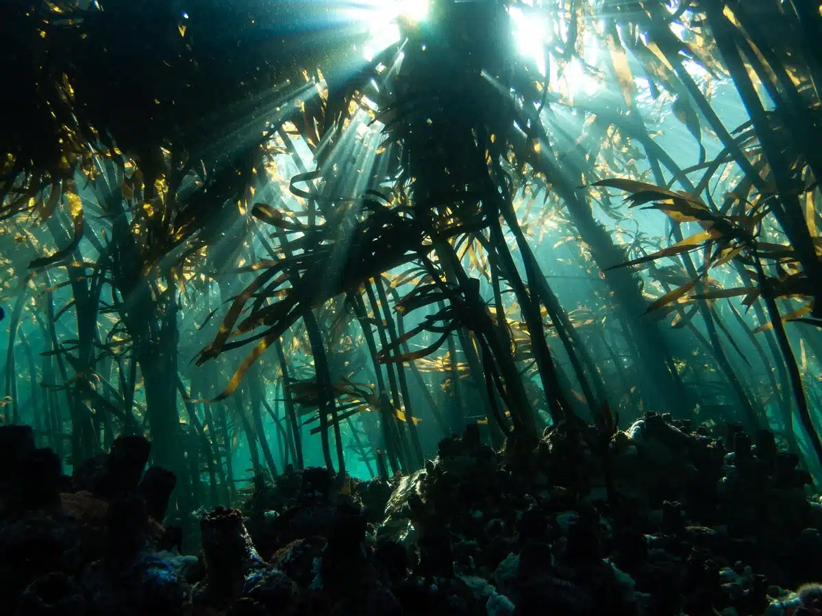
© Photo: Hayd Basson
The last results are a very significant finding. Before this research, not enough was known about the effects of complex mixtures and long-term exposure to pollutants. The cumulative results of the tests are very concerning, especially when they are contextualised within other studies that find dramatic declines in human fertility. Every one of the toxins reduced the sperm’s speed. And, while only one of the toxins tested did not have a significantly negative impact on sperm’s ability to swim, this parameter on its own doesn’t capture the subtler effects of exposure to environmental toxins, especially when they are mixed into different compounds at various concentration levels, as the team deliberately did in their study to mimic what’s happening in the real world.
Hopes for future testing include examining whether people who have been exposed to toxins can recover when exposure stops, as well as working on some genetic screening tools that can be used to support future improvements in human health and disease. Even if the results of their work are alarming, the team feels optimistic that their ground-breaking approach will be useful in both environmental and human health care.
The solution is everyone’s responsibility
“Our coastline from Green Point all the way around the Peninsula, and including False Bay from Miller’s Point to Rooi Els, is contaminated by chemicals from inadequately treated sewage,” says Professor Leslie Petrik. A large volume of so-called ‘treated water’ is discharged into False Bay, from wastewater treatment plants, but the contamination levels are high.
Inland, the situation is no less serious which impacts the coastline and the ocean. Zeekoevlei — South Africa’s largest freshwater lake, a Ramsar wetland of international importance, and a body of water that drains directly into False Bay — has been closed to all recreational activity since December 2025 due to a toxic cyanobacteria bloom. Microcystin toxin levels reached 276 micrograms per litre, against a high-risk threshold of 20 micrograms per litre, fuelled by continuous sewage and agricultural runoff from the Big Lotus River. The closure has affected schools, rowing clubs, and wildlife, and underscores the systemic failure of catchment management upstream of the bay.
The City’s own Know Your Coast report states: “Put simply, coastal and marine environments do not have endless capacity to assimilate waste and waste streams produced by society. If this is not managed and controlled, we risk damaging or even losing one of our greatest economic, social and environmental assets – our coast. “
While the City needs to fix its currently failing wastewater treatment plants, and improve wastewater treatment in order to remove pharmaceuticals, persistent organic compounds and perfluoroalkyls before releasing the effluent back into the environment, massive public education is also required.

Zandvliet Water Water Treatment Plant © Zutari 2022
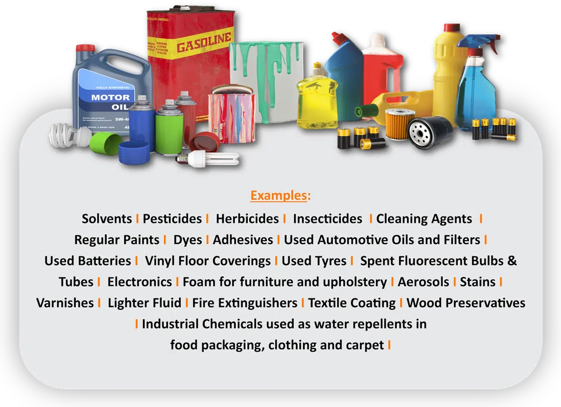
The City’s entire stormwater system releases the collected water into the sea untreated, either directly or via rivers and streams. Whatever is put into the stormwater system goes directly into the environment, this includes paint, motor oil, disinfectants and all manner of chemicals disposed of in households and by industry. Stormwater drains also convey sewage spills from broken infrastructure to the sea. Education, and if necessary, enforcement, to prevent disposal of chemicals via the stormwater system is essential.
Households can also play their part by ensuring we use only natural, biodegradable personal care and household products in our homes, so as not to contribute to the volumes of ‘forever chemicals’ entering our environment. If you take a look at our Take Action Page, there are many tips on how to change your household and shopping habits, understanding chemicals, how to engage with the community and municipality, and ideas of where to volunteer. You can also read more about water pollution, water sources, history, water protectors and other information on this website.